Augmented Reality (AR)
Augmented reality (AR) is an advanced technology, which can be useful for improving industry, health, commerce, entertainment industry and, what is the most important, education. Augmented reality is a combination of a reality and further details added to the field of vision.
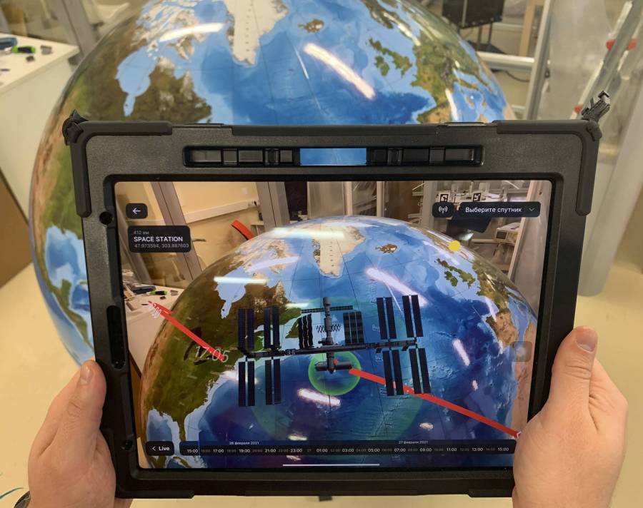
Due to this technology students can learn near-Earth space, orbits of the satellites and their varieties, to see satellite’s actual location and his movement.
Main features of augmented reality:
1) Displaying satellite’s flight:
- Display of satellites nearby Terra in real time, scrolling time during 24 hours;
- Adding of satellites on the orbit by the Norad-ID (Satellite Catalog Number);
- Displaying the orbit of the selected satellite (in the non-inertial ECEF system): the ground route of the orbit and the orbit itself, timestamps;
- The satellite's visibility zone is visualized (satellite signal reception area);
- 10 forms of satellite visualization are available;
- Visualization of the ISS flight;
- Displaying of several ground stations by coordinates (with a name).
2) Visualization the Earth remote sensing process (based on METEOR-M2).
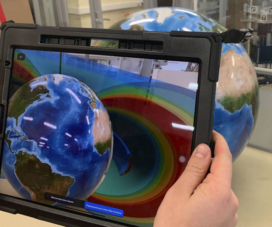
3) Visualization of the magnetic field of the Earth:
- Shape of the field;
- Relative position of the magnetic field’s axes and the axis of rotation of the Earth;
- Brazilian and the Cape Town anomalies;
- The Van Allen radiation belt.

4) Visualization of the Keplerian elements of the orbit (with the ability of the interactive change):
- Semi-major axis;
- Inclination;
- The Ascending Node;
- Eccentricity;
- For 0 < ε < 1 – perigee and apogee (pericenter, apocenter);
- Argument of the pericenter (or the longitude of the pericenter);
- A true anomaly;
- Visualization of the velocity change for elliptical orbit;
- Visualization of the basic types of orbits near the Earth:
- Circular, elliptical, parabola, hyperbola;
- Sun-synchronous orbit, Polar, Molniya.
There is also addition in the application, which allows not only to visualize objects, but also to demonstrate clearly:
Working principles with Mission control center (field of visibility, the number of sessions, satellite’s height above the station);
The difference between Earth Center Inertial Coordinates (ECI) and Earth Centered Earth Fixed (ECEF) (the visualization of the Keplerian elements);
Principles of the satellite engineering for spacecrafts with the orbit until 700 km – 1000 km (as an example - magnetic field’s unit);
The principle of space orientation by the magnetic field and sun (as an example - magnetic field’s unit);
Earth remote sensing principle (if there is the station Viewnok/Zavitok you can watch the lessons– receiving and transcription of an image by the visualization of AR).
The software requires an Internet connection.