Searching satellites for AR visualization
With the software Gpredict you can find quickly NORAD ID of the satellites you are interested in for learning their orbits in augmented reality.
Open Gpredict and update TLE data (picture 1):
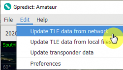
Picture 1. Updating TLE
In the right drop-down menu choose Configure (picture 2):
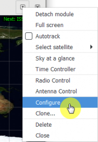
Picture 2. “Configure” button
Choose All satellites from the drop-down list (picture 3):
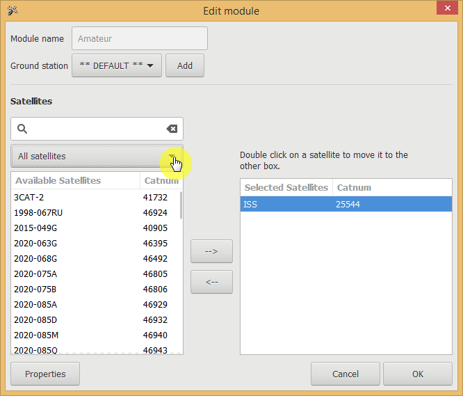
Picture 3. Drop-down list of satellites
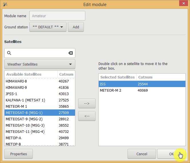
Choose Weather satellites. Find Meteor-M 2 and click the name twice to add this satellite to the list (picture 4):
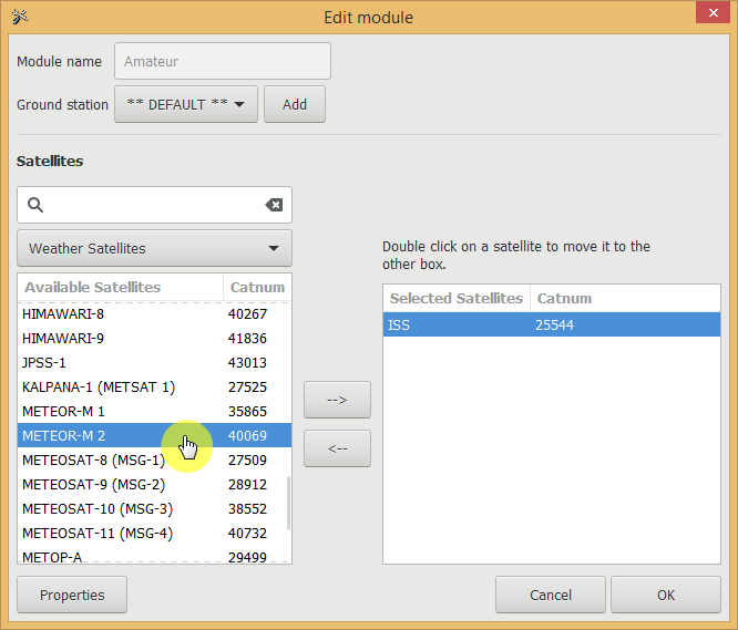
Picture 4. Choosing “Meteor-M 2”
Press Ок (picture 5):
Picture 5. “OK” button
Then go to the main menu and choose the added satellite (picture 6):
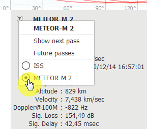
Picture 6. Choosing added satellite
Choose satellite on the map by the right click and turn on Ground Track (picture 7):
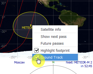
Picture 7. Displaying the orbit projection
The red line on the map will show the trajectory of the next three satellite flights. You can find information about altitude in the table (Altitude) (picture 8):
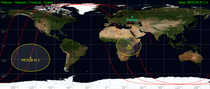
Picture 8. Track of the satellite
Choose one of the Molniya’s satellites and add it to the list (picture 9):
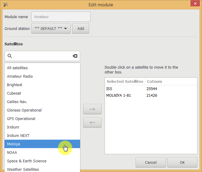
Picture 9. List of Molniya orbit satellites
These satellites have interesting orbits (picture 10):
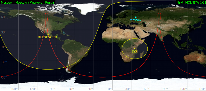
Picture 10. Satellite orbits
You can add the Cubesat type nanosatellite from Cubesat section (picture 11):
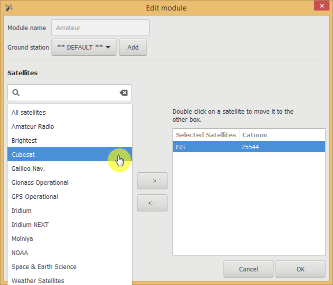
Picture 11. Adding list of CubeSat satellites
Make experiments!
Find interesting orbits and share in the social media!