Adding the ground station and satellites for visualization in AR
Adding the ground station
Open the application and choose is Settings scan mode (label or Terra) (picture 1):
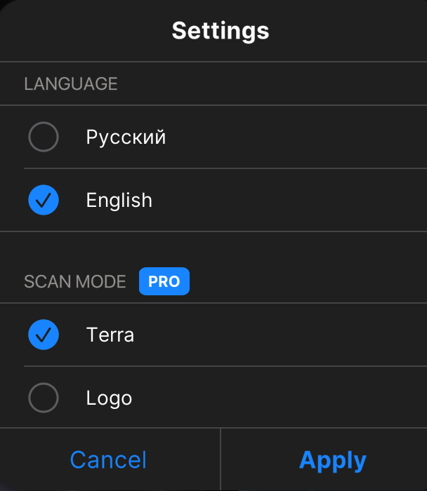
Picture 1. Choosing the scan mode
Then choose “Satellites and their orbits” module (picture 2):

Picture 2. Modules of application
By default, in the satellite’s list at the top right corner is ISS (picture 3):
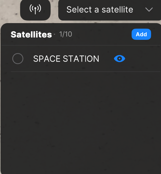
Picture 3. Satellite's list
First of all, you should add the ground station – to point location on the globe.
Put in geographical coordinates (longitude and latitude), and then the name of the station. You can add several stations at the same time in the application. You can see the example of adding the ground station with the name Station on the picture 4:
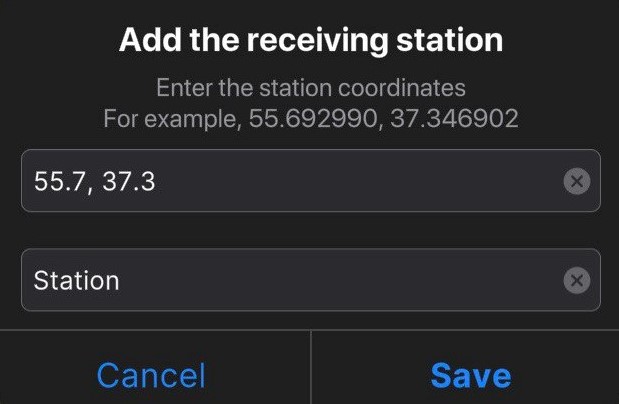
Picture 4. Adding station
You will see stations in augmented reality (picture 5):

Picture 5. Visualization of the ground station in AR
Adding satellites in "Satellites and their orbits" module
To add the satellite fill in his NORAD ID and choose one of four versions of visualization: 1U, 3U, 6U or Meteor. On the picture 6 is an example of how to add the satellite ORBICRAFT-ZORKIY:
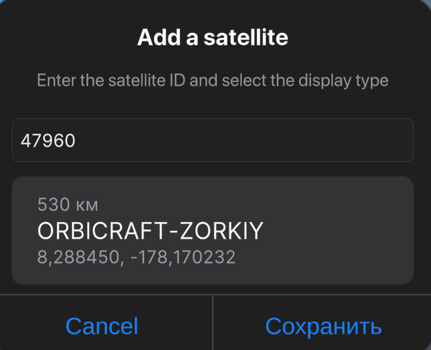
Picture 6. Adding new satellite