Orbits of navigation satellites
Information about navigation satellites
Currently there are several satellite navigation systems created by the leading space-faring countries.
GPS
GPS is created by the USA. It works since 1978 year. A space segment consists of 32 satellites GPS III/IIIF type, spinning around the Earth in the circular orbits with the same height and the orbital period for all satellites (picture 1):
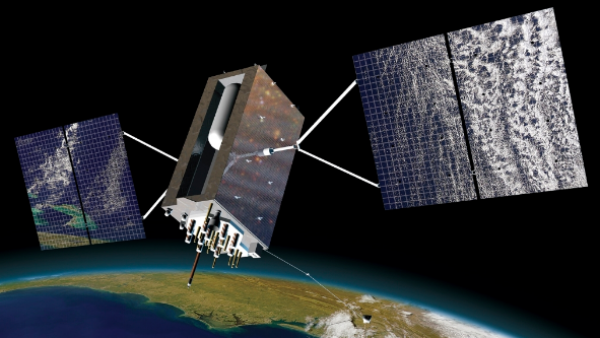
Picture 1. GPS satellite
Circular orbit with a height about 20 200 km (the orbital radius is about 26 600 km) is the orbit of daily multiplicity with an orbital period 11 hours 58 minutes. The satellite is making two flights around the Earth during one sidereal day (23 hours 56 minutes). The orbit’s inclination (55°) is the same for all satellites of the system.
GLONASSx
Global navigation satellite system is a Russian navigation system. It was created in 1982 year. A space segment consists of 24 satellites Glonass-M and Glonass-K types (picture 2):
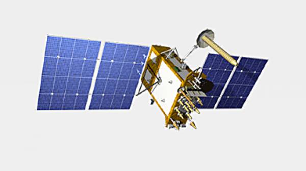
Picture 2. GLONASS satellite
Satellites moving over the Earth’s surface in three orbital planes with an inclination 64,8° and an altitude of the orbit 19100 km. Measuring principle is similar to the American navigation system GPS. The basic difference from GPS system is that GLONASS satellites don’t have synchronicity with the rotation of the Earth in the orbital motion, which is providing them a greater stability. Constellation of spacecraft GLONASS don’t need further adjustments during the whole period of active lifetime.
Galileo
Galileo is the European satellite navigation system. It was launched in 2016 year. Currently there are 24 of 30 necessary satellites on the orbit (picture 3):
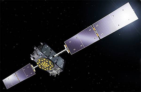
Picture 3. Galileo satellite
Galileo satellites are launching on the circular earth-centered orbits with a height 23 222 km (or 29 600 km from the Earth’s center), fly around the Earth for 14 hours 4 minutes 42 seconds and rotate in three planes, inclined at 56° to equator. The ascending node each of three orbits is lagging behind for 120° from two others. On every orbit with the full deployment of the system will be based 8 active and 2 backup satellites. Because of the higher orbit than GPS’s satellites, on the latitude of the polar circle will be provided accurate to 1 m.
You can use Gpredict software to find the NORAD ID of navigation satellites. Visit this page to learn how to find the NORAD ID - Searching satellites for AR visualization
Visualization of the navigation satellite’s orbits in AR
Add one of the spacecrafts from GPS constellation of spacecrafts with NORAD ID 35752 (picture 4):

Picture 4. GPS satellite in augmented reality
That’s how looks the GPS orbit in AR. To find a satellite, rotate iPad because the satellite could be higher or lower than the globe Terra (picture 5):

Picture 5. The orbit of the GPS satellite
Now let's look at the orbit of the Russian GLONASS satellite with the catalog number NORAD ID 42939 (picture 6):

Picture 6. The GLONASS satellite in augmented reality
You can see its orbit on the picture below. There are the attitude of the satellite and his current coordinates (picture 7):
Picture 7. The orbit of the GLONASS satellite
Rotate iPad to find the satellite, because it could be under the ceiling (picture 8):

Picture 8. GLONASS satellite model
Add the orbit of the European satellite Galileo with the NORAD ID 43058. On the picture below you can see its orbit (picture 9):

Picture 9. The Galileo satellite in augmented reality
Rotate iPad to find the satellite.